Last Updated on July 5, 2023

If you have never been to California you must know that it has a lot to offer. California is a big state and there more than Los Angeles, San Diego or San Francisco… If you have an RV you want to see the more natural side of the state. Thankfully, there are a number of nice drives and routes that will take you and your RV through some of the best spots to see. Each route offers different breathtaking views and allows you to see nature up close and personal. No matter which way you go, you will see beautiful places in California.
The 5 Best Scenic Driveways in California
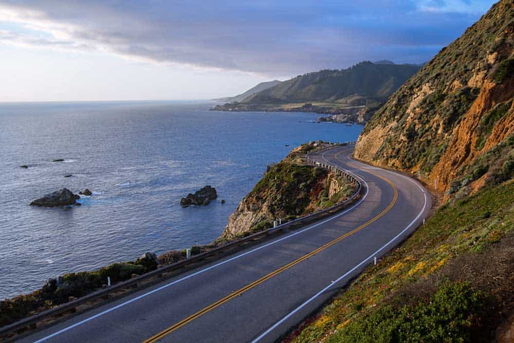
Big Sur Coast Highway
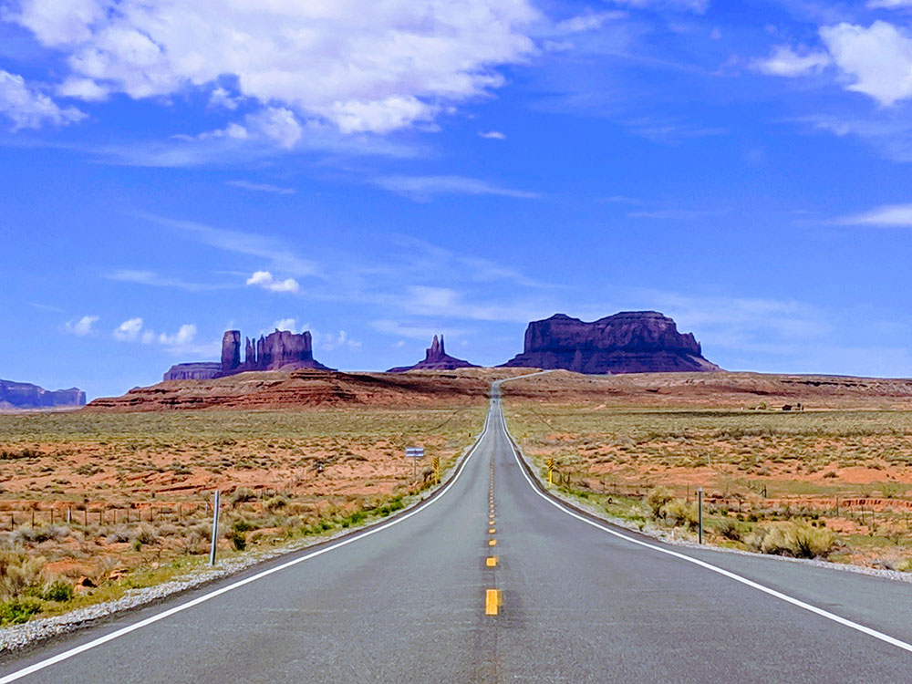
California is known for its beautiful coastline and beaches and Route PCH 1 is the best way to see them all. Hugging the entire coast, you can travel the length of California at the edge of the Pacific. Along the Big Sur Coast portion of the drive, you will see windswept cypress trees, rugged canyons, towering Redwood trees, fog-covered cliffs, crashing waves, and even marine life frolicking in the sea. The length of this All-American road is approximately 72 miles and you can drive this in a little under two hours, or up to five hours depending on how many times you stop to take in all the beauty. You start at the San Luis Obispo County line and follow signs to State Highway 1/Cabrillo Highway. Be aware that around the Big Sur area the road will be windy. It might be a little challenging with a large RV. I’ve done this with my Class C RV and was able to do it. I just need to pay more attention.
[amazon table=”11051″]
Death Valley Scenic Byway
If the coast is not your thing, California has plenty of deserts to share with you too. The Death Valley Byway shares over 3.3 million acres of expansive desert terrain, historical and cultural landmarks, and rare desert wildlife. You drive through what seems like endless sculpted hills and sand dunes as you reach both the lowest point in North America as well as the hottest. Driving the full length takes anywhere between 2 and 4 hours and there is an entrance fee to the national park located along the way. Your trip will start at the eastern entrance to Death Valley National Park and you drive along Highway 190 past Stovepipe Wells, Panamint Valley, and Crowley Point. There are nice boodnocking places in the area as well.
Arroyo Seco Historic Route 110
Discover the historical and cultural side of the state by driving between Los Angeles and Pasadena through this Arts and Crafts landscape. This parkway is designed with traditional curves, beautiful landscape, and scenic vistas. The parkway also incorporates history with modern elements as it laid groundwork to become part of the California freeway system. This stretch of road in approximately 9.5 miles long and depending on the rush hour, the drive time will vary. Begin your cruise at Four Level, which is the intersection of US 101 and State Route 110 in downtown Los Angeles. Take Route 110 all the way through to Pasadena, getting off at Colorado Boulevard to enjoy the delightful area of Old Town Pasadena.
Tioga Road/Big Oak Flat Road
Take the high road and drive through the scenic Sierra Nevada mountains. As the highest automobile pass in the state, you can see the elevation change right before your eyes. Stop the RV along the way to enjoy crystal clear lakes, luscious evergreen forests, wildflower-filled meadows, and granite peaks that were carved from glaciers. Peace, quiet, and fresh air will keep you relaxed as you take in this serene landscape. You start at the Big Oak entrance to Yosemite National Park (there is a fee to enter) and wind your way through, sticking to SR 120 until you reach Tioga Pass at the other end.
Ebbetts Pass Scenic Byway
Check out ancient volcanic peaks, glacier-carved valleys, and canyons galore as you drive through Ebbetts Pass. You can experience groves of sequoias as you drive through the narrow ribbon roads seeing the countryside up close and personal. Snowcapped mountains form the backdrop of this drive for most of the year and during the winter, the terrain is great for skiing. Begin your drive in Arnold at State Route 4 and travel northeast to SR89, which will take you all the way to the end of the road in Markleeville.